CLEAR COMPASS ROUTING
Build the route. Then see how it actually ran.
Clear Compass Routing plans your stops, students, and routes on a live map, then checks that plan against real GPS data, ridership scans, and allows you to seamlessly connect this all to the live cameras on the bus.
REQUEST A DEMO
WATCH THE 2-MINUTE OVERVIEW
The plan and the road drift apart
Routing software is good at producing a plan. Then that plan meets the real world, and the first you hear of it is a parent calling. A stop gets skipped. A driver finds a safer turnaround and quietly keeps using the turnaround. A student boards a bus without an assignment. Across a school year the route on the screen and the route on the road drift away from each other. The gap stays invisible until something goes wrong.
Clear Compass runs on the same platform as the cameras, GPS, and card readers fitted to Transportant buses. Your plan and the record of what actually happened sit in one system, so you can compare the plan against the record any day of the week.
Build a route in under a minute
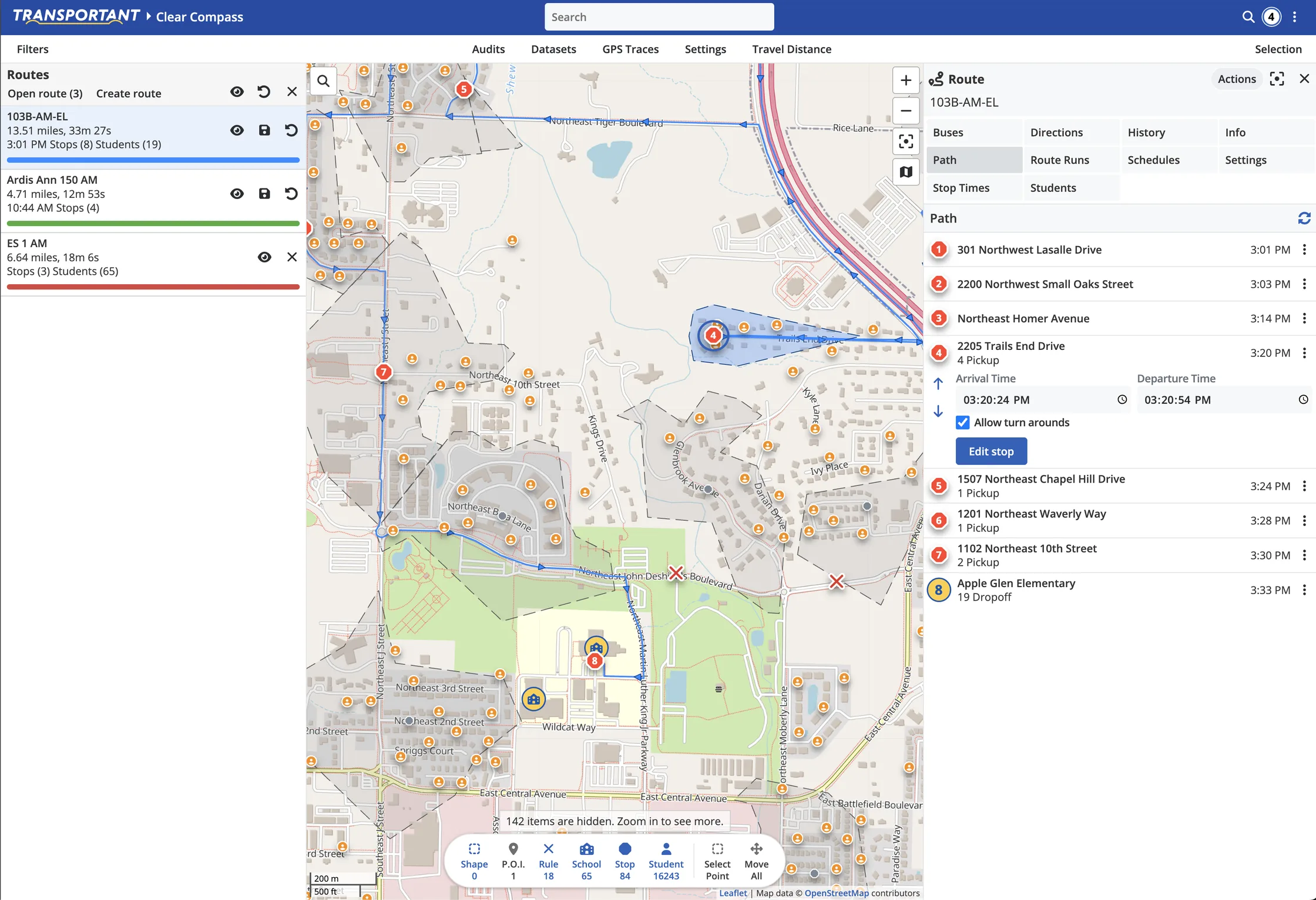
Filter the map to the school you are working on and the system automatically adds the student population. Right-click to drop a stop. Draw a polygon around the neighborhood and the students inside are picked up. Add a few more stops, connect them into a route, and optimize the stop order.
Draw stops, routes, and no-go areas straight onto the map
Road data comes from OpenStreetMap, without any fiddly data imports
Shape the path with waypoints, and calculate routes that avoid highways, u-turns, ferries, and tolls
Optimize the order of stops on a route
Review and approve turn-by-turn directions before a driver sees them, and add your own direction text where a map cannot explain a turnaround
See route length in both time and distance

Assign students without working through them one at a time
Import students, stops, and routes from your SIS or from your existing routing system
Assign students to stops manually or by drawing a net around a neighborhood
Auto-assign students based on the school they attend and their address schedule
Handle students with more than one address and more than one school, with an address schedule that records when a student is at each address
Set bell times per school and build route schedules against them
Prevent specific routes from being altered by third-party routing software so you can work on them in Clear Compass alone
Find the problems before a parent does
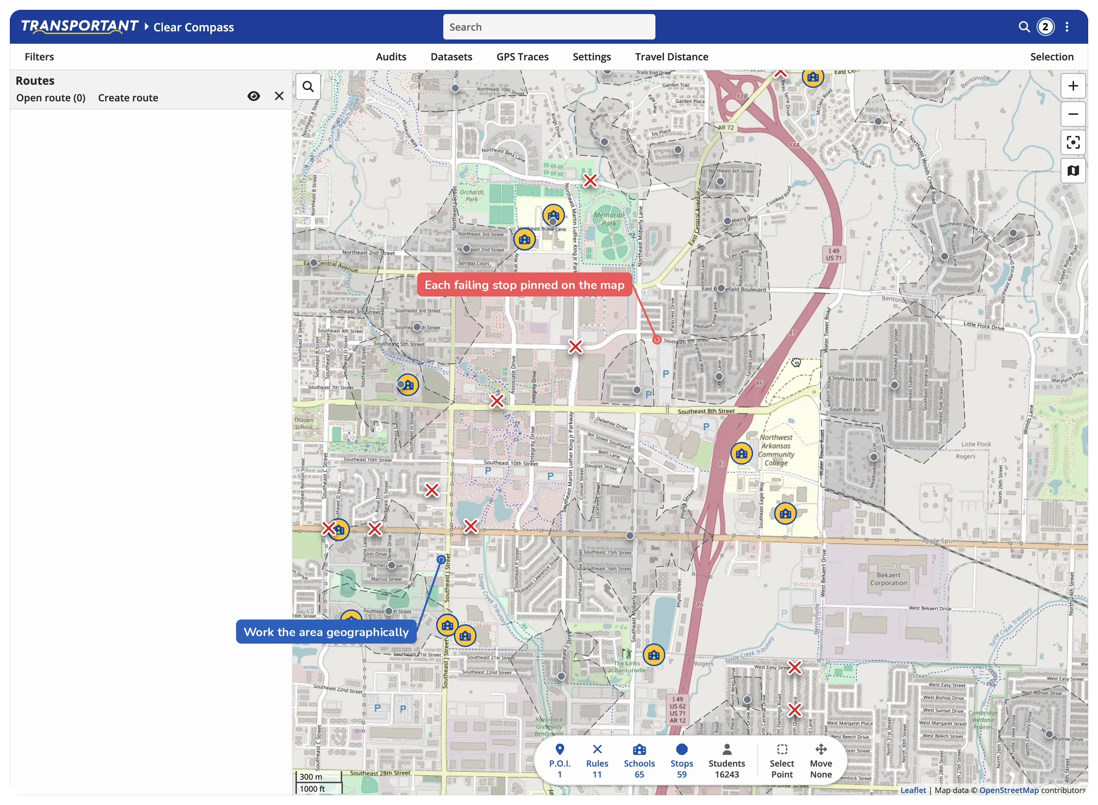
Clear Compass Routing ships with a standing set of audits that read across your database and surface what is broken or missing.
Routes with no path, no assigned bus, no schedule, no stops, or no students
Students with no address, no school, no route, or a missing pickup or dropoff
Stops with no students, stops with no route, and stops sitting within thirty feet of each other
Schools that were never mapped, have no bell times, or are not served by any route
Records that landed a hundred miles from the district, or outside the country
School, stop, and student audits display as a list and directly on the map. Click a result and the map jumps to it. You start the day with a list of what to fix.
Check the plan against the road
With Transportant GPS and ridership hardware on the bus, Clear Compass adds a second layer of reporting.
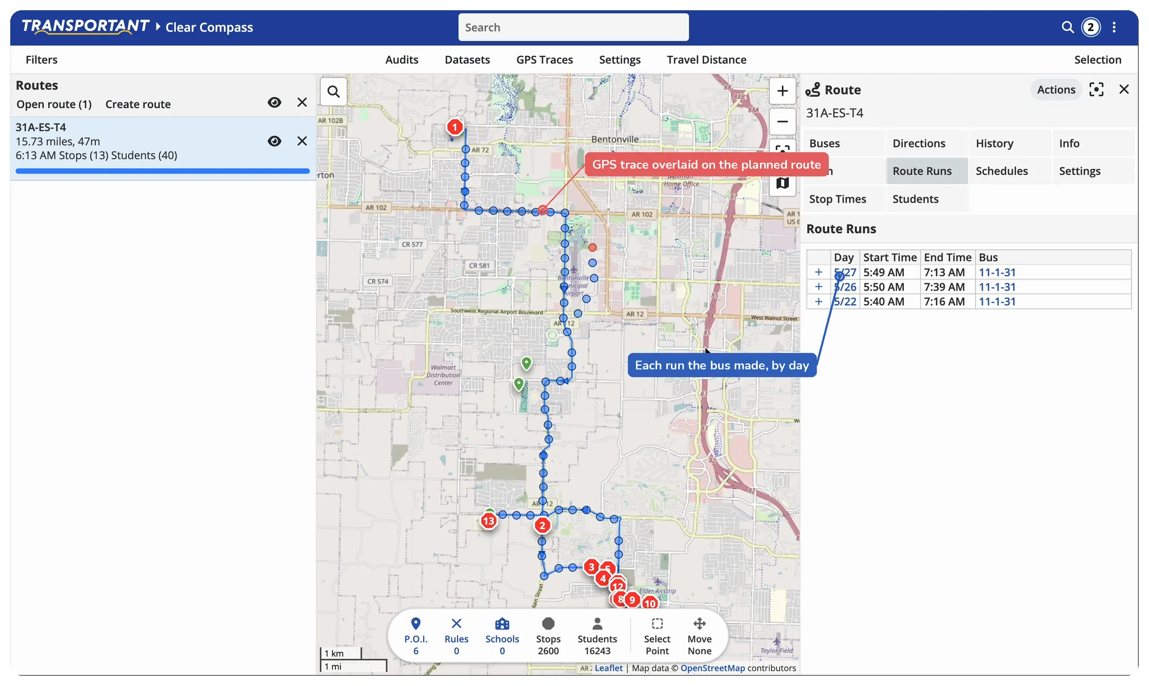
Overlay live and historical GPS traces on top of the planned route
Compare actual stop times against planned stop times
Surface students assigned to a route who have not boarded a bus recently
Surface students boarding a bus who are not assigned to any route
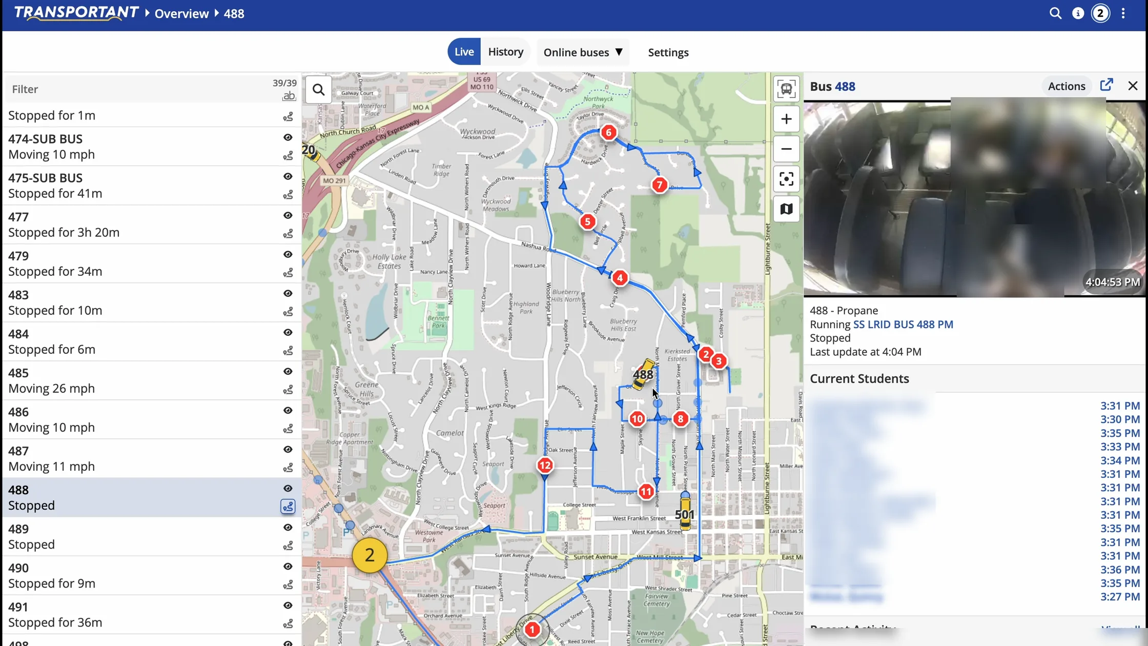
Pull camera frames for route events, including student card swipes, route starts and ends, and incidents
Routing vendors do not build cameras, and camera vendors do not build routing. Transportant builds both, which is why a camera frame can sit against a route event in the same record.

Works with Copilot and the parent app
Clear Compass Routing publishes to Copilot, the Transportant driver tablet application. Drivers get turn-by-turn guidance along the path the office approved, and students are tracked on and off the bus. A substitute driver gets the same directions your regular driver runs.
Parents see bus location and delay alerts through the parent app.
Built alongside working districts
The feature list comes out of regular working sessions with transportation directors who run district routes every day. Stop tagging, right-click stop creation, bulk route duplication, and school-level filtering are all in the build queue because a district asked for them in one of those sessions.
See Clear Compass on your own district’s data
We will import a sample of your students, stops, and routes and run the audits against them, so the first thing you see is your own database rather than a demo district.